Swain County Resources
- View All:
- Biographies
- Monuments
- locations
ANCHOR (A North Carolina History Online Resource) is now its own website!
Copyright Notice: This article is from the Encyclopedia of North Carolina edited by William S. Powell. Copyright © 2006 by the University of North Carolina Press. Used by permission of the publisher. For personal use and not for further distribution. Please submit permission requests for other use directly to the publisher.
See also: Cherokee Indians; Great Smoky Mountains National Park; Museum of the Cherokee Indian; Oconaluftee Indian Village.
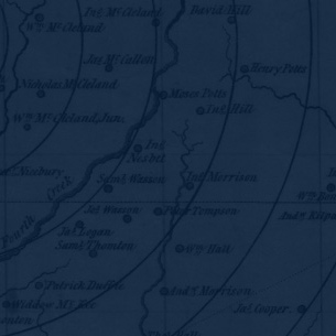
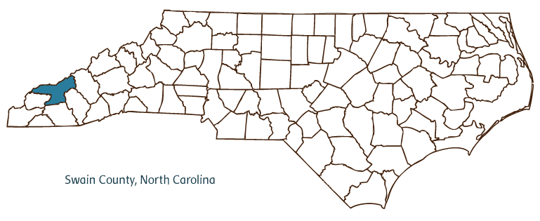
Swain County, located in the Mountain region of North Carolina, was formed in 1871 from Jackson and Macon Counties and named for David Lowry Swain, governor of North Carolina and president of the University of North Carolina in Chapel Hill. It is situated along the Tennessee-North Carolina border. Early inhabitants of the area included the Cherokee Indians; early European settlers were Scotch-Irish and German. Bryson City, the county seat, was incorporated in 1887 as Charleston; the name was changed in 1889 in honor of Capt. Thaddeus Dillard Bryson, the founder of the town. Other Swain County communities include Cherokee, Birdtown, Ela, Lauada, Wesser, Almond, and Nantahala.
Two of Swain County's principal features are large sections of the Great Smoky Mountains National Park and the Qualla Boundary, the reservation of the Eastern Band of Cherokee Indians, with Cherokee as its primary town. These dominate the economy of the county, bringing thousands of tourists to the area year round and giving Swain County its distinctive cultural identity. Fontana Lake, a reservoir created by Fontana Dam, built during the New Deal, is a popular recreational area for swimming, boating, fishing, and hiking. Whitewater rafting on the Tuckasegee, Oconaluftee, and Little Tennessee Rivers is another popular activity in the county.
Although tourism is the main source of revenue in Swain County, the county also gains income from forestry and from agricultural commodities such as burley tobacco, tomatoes, boxwoods, ornamentals and other nursery crops, Christmas trees, beef cattle, and dairy products. Minerals in the county include kyanite, pegmatite, clay, feldspar, quartz, garnet, pyrite, magnetite, and thulite.
Swain County is the site of several historic landmarks, among them Nantahala No. 2 Truss Bridge, built in 1899; the Kituwah Indian Mound, once the center of an early Cherokee settlement along the Tuckasegee River; and Oconaluftee Indian Village, established in 1952 and part of the Great Smoky Mountains National Park. Prominent among the county's cultural institutions are the Museum of the Cherokee Indian and the long-running outdoor drama Unto These Hills, presented in Cherokee and telling the story of the Eastern Cherokees' removal to Oklahoma on the Trail of Tears. Other cultural attractions include the Smoky Mountain Community Theatre, the Cherokee Cyclorama Wax Museum, the Qualla Arts and Crafts Mutual, and the Cherokee Heritage Museum and Gallery. The county hosts festivals and annual events such as Bryson City Riverfest, the Fourth of July Freedom Fest, the Fireman's Day Festival, the Bryson City Chili Cookoff, and the Cherokee Blue Grass Festival. In 2004 the estimated population of Swain County was 13,400.
For an annotated history of the county's formation, with the laws affecting the county, boundary lines and changes, and other origin information, visit these references in The Formation of the North Carolina Counties (Corbitt, 2000), available online at North Carolina Digital Collections (note, there may be additional items of interest for the county not listed here):
County formation history: https://digital.ncdcr.gov/Documents/Detail/the-formation-of-the-north-ca...
Index entry for the county: https://digital.ncdcr.gov/Documents/Detail/the-formation-of-the-north-ca...
Additional resources:
Corbitt, David Leroy. 2000. The formation of the North Carolina counties, 1663-1943. https://digital.ncdcr.gov/Documents/Detail/the-formation-of-the-north-carolina-counties-1663-1943/3692099?item=4553233 (accessed June 20, 2017).
Swain County Government: https://www.swaincountync.gov/
Swain County Chamber of Commerce: http://www.greatsmokies.com/
DigitalNC, Swain County: https://www.digitalnc.org/counties/swain-county/
North Carolina Digital Collections (explore by place, time period, format): https://digital.ncdcr.gov
Image credits:
Rudersdorf, Amy. 2010. "NC County Maps." Government & Heritage Library, State Library of North Carolina.
Mazzocchi, Jay. "Swain County." NCpedia. Library of NC. 2006.

SWAIN COUNTY GOVERNMENT:
www.swaincountync.gov
COUNTY SEAT: Bryson City
FORMED: 1871
FORMED FROM: Jackson, Macon
LAND AREA: 528.00 square miles
2020 POPULATION ESTIMATE: 14,117
White: 63.1%
Black/African American: 1.2%
American Indian: 30.1%
Asian: 0.7%
Pacific Islander: <0.1%
Two or more races: 4.9%
Hispanic/Latino: 5.8% (of any race)
From State & County QuickFacts, US Census Bureau, 2020.
CONGRESSIONAL DISTRICT: 11TH
BIOGRAPHIES FOR![]()
Swain County
 WILDLIFE PROFILES FOR
Mountain region
GEOGRAPHIC INFORMATION
REGION: Mountain
RIVER BASIN: Little Tennessee, Map
NEIGHBORING COUNTIES: Graham, Haywood, Jackson, Macon