ONSLOW COUNTY GOVERNMENT:
www.onslowcountync.gov
COUNTY SEAT: Jacksonville
FORMED: 1734
FORMED FROM: New Hanover
LAND AREA: 762.74 square miles
2020 POPULATION ESTIMATE: 204,576
White: 76.2%
Black/African American: 15.8%
American Indian: 0.9%
Asian: 2.2%
Pacific Islander: 0.3%
Two or more races: 4.6%
Hispanic/Latino: 12.9% (of any race)
From State & County QuickFacts, US Census Bureau, 2020.
CONGRESSIONAL DISTRICT: 3RD
BIOGRAPHIES FOR![]()
Onslow County
 WILDLIFE PROFILES FOR
Coastal Plain
GEOGRAPHIC INFORMATION
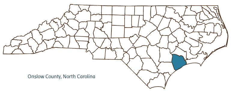
REGION: Coastal Plain
RIVER BASIN: Cape Fear, White Oak, Map
NEIGHBORING COUNTIES: Carteret, Duplin, Jones, Pender
See also: Camp Lejeune.
Onslow County, located in the Coastal Plain region of southeastern North Carolina, was formed in 1734 from New Hanover County and named for Arthur Onslow, Speaker of the House of Commons in the British Parliament. The county is bordered in part by the Atlantic Ocean. Early inhabitants of the region included Siouan Indians, followed by English, Welsh, French, Swiss, Scottish, and German settlers. Jacksonville, the county seat, was established and incorporated in 1843 and named for President Andrew Jackson; formerly, the county seat had been Onslow Courthouse. Other communities in Onslow County include Swansboro, Sneads Ferry, Midway Park, Hubert, Dixon, Folkstone, and Petersburg. Notable physical features of the county, in addition to the extensive coastline, include the New River, Onslow Bay, Stones Creek, Catherine Lake, Onslow Beach, and Wolf and Bachelors Delight Swamps.
Camp Lejeune Marine Base is in many ways a dominant factor in the life and economy of Onslow County. The base, established during the World War II era, is home to the Second Marine Expeditionary Force, making Jacksonville-like Fayetteville in Cumberland County-one of the United States' principal military cities. The county's economy is also strengthened by its coastal location; Topsail Island, situated along the Atlantic coast, brings in thousands of vacationers and tourists each year (the northeastern end of the island, including the community of North Topsail Beach, lies in Onslow County, while the southwestern end is in adjacent Pender County).
Otway Burns, a privateer in the War of 1812, built the first steamboat in Onslow County in 1818. The county has several historic attractions, such as Historic Swansboro, Mumfort Historic Cemetery, and the Beirut Memorial, erected to honor all servicemen who died in Lebanon and Grenada in 1983. The Montford Point Marine Museum presents the history of the World War II recruit training depot for African American marines. County cultural institutions include Opera Carolina and the Onslow County Crafts Guild. The county hosts popular annual events such as the Onslow County Fair, the Sneads Ferry Shrimp Festival, Swansboro Arts-by-the-Sea, the Topsail Island Kite Festival, and the Coastal Storytelling Festival.
Onslow County agricultural products include tobacco, fruits and vegetables, cattle, swine, and poultry. Fishing and forestry contribute significantly to the county's economy as well. Manufactures from Onslow County include textiles, plywood, fuel injectors, meat products, and yachts. In 2004 the population of Onslow County was estimated to be 159,700.
Annotated history of Onslow County's formation:
For an annotated history of the county's formation, with the laws affecting the county, boundary lines and changes, and other origin information, visit these references in The Formation of the North Carolina Counties (Corbitt, 2000), available online at North Carolina Digital Collections (note, there may be additional items of interest for the county not listed here):
County formation history: https://digital.ncdcr.gov/Documents/Detail/the-formation-of-the-north-ca...
Index entry for the county: https://digital.ncdcr.gov/Documents/Detail/the-formation-of-the-north-ca...
Additional resources:
Corbitt, David Leroy. 2000. The formation of the North Carolina counties, 1663-1943. https://digital.ncdcr.gov/Documents/Detail/the-formation-of-the-north-carolina-counties-1663-1943/3692099?item=4553233 (accessed June 20, 2017).
Onslow County Government: http://www.onslowcountync.gov/
Jacksonville Onslow Chamber of Commerce: https://jacksonvilleonline.org/
DigitalNC, Onslow County: https://www.digitalnc.org/counties/onslow-county/
North Carolina Digital Collections (explore by place, time period, format): https://digital.ncdcr.gov
Image credits:
Rudersdorf, Amy. 2010. "NC County Maps." Government & Heritage Library, State Library of North Carolina.
1 January 2006 | Mazzocchi, Jay