Tennessee, Formation of
See also: Franklin, State of.
 Prior to the American Revolution, white settlers were building cabins along the Watauga and Nolichucky Rivers in the western part of the North Carolina colony. In 1772 they drew up a compact called the "Watauga Association." Four years later they petitioned North Carolina to extend its jurisdiction over their area, and the following year North Carolina created Washington County with boundaries that included all of modern Tennessee. Between 1779 and 1788 the state legislature established six additional counties in the Tennessee country: Sullivan (1779), Greene (1783), Davidson (1783), Sumner (1787), Hawkins (1787), and Tennessee (1788).
In 1784 the General Assembly ceded the state's western lands to the United States, then revoked the cession later that year. Nevertheless, the frustrated settlers, led by John Sevier, organized the State of Franklin with a constitution, a separate legislative body, and Sevier as governor. The Continental Congress, as well as Virginia and North Carolina, refused to recognize the new state, and it soon collapsed. In 1789 North Carolina ceded its western lands to the newly established federal government, and on 1 June 1796 Tennessee was admitted to the Union as the sixteenth state. Sevier was elected governor.
References:
Noel B. Gerson, Franklin: America's "Lost State" (1968).
Hugh T. Lefler and Albert R. Newsome, North Carolina: The History of a Southern State (3rd ed., 1973).
William S. Powell, North Carolina through Four Centuries (1989).
Additional Resources:
"Cessions to the United States.Tennessee. An Act for the Purpose of Ceding to the United States of America, Certain Western Lands Therein Described." Revised statutes of the State of North Carolina, passed by the General Assembly at the session of 1836-7. Raleigh [N.C.]: Turner & Hughes. 1837. p.171. https://digital.ncdcr.gov/Documents/Detail/revised-statutes-of-the-state-of-north-carolina-passed-by-the-general-assembly-at-the-session-of-1836-7-including-an-act-concerning-the-revised-statutes-and-other-public-acts-passed-at-the-same-session-...-v.2/2691256?item=2816703
Scott, Joseph and Smith, Daniel. "A map of the Tennassee government, formerly part of North Carolina, taken chiefly from surveys by Gen. D. Smith & others." [Philadelphia]: [M. Carey]. circa 1794. http://dc.lib.unc.edu/cdm/singleitem/collection/ncmaps/id/141/rec/10
Image Credits:
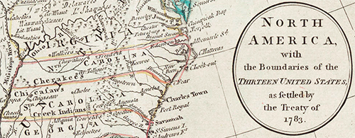
"North America with the boundaries of the thirteen United States, as settled by the Treaty of 1783" (map). http://dc.lib.unc.edu/cdm/singleitem/collection/ncmaps/id/66/rec/9
1 January 2006 | Williams, Wiley J.