
CABARRUS COUNTY GOVERNMENT:
https://www.cabarruscounty.us/
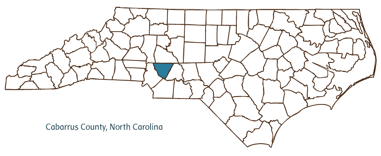
COUNTY SEAT: Concord
FORMED: 1792
FORMED FROM: Mecklenburg
LAND AREA: 361.75 square miles
2020 POPULATION ESTIMATE: 225,804
White: 72.4%
Black/African American: 19.6%
American Indian: 0.7%
Asian: 4.7%
Pacific Islander: 0.1%
Two or more races: 2.4%
Hispanic/Latino: 11.1% (of any race)
From State & County QuickFacts, US Census Bureau, 2020.
CONGRESSIONAL DISTRICT: 8TH
BIOGRAPHIES FOR![]()
Cabarrus County
 WILDLIFE PROFILES FOR
Piedmont region
GEOGRAPHIC INFORMATION
REGION: Piedmont
RIVER BASIN: Yadkin Pee-Dee, Map
NEIGHBORING COUNTIES: Iredell, Mecklenburg, Rowan, Stanly, Union
Cabarrus County, located in North Carolina's south central Piedmont, was formed in 1792 from Mecklenburg County and named for Stephen Cabarrus, then Speaker of the North Carolina House of Commons. Catawba Indians were the primary inhabitants of the area when Scotch-Irish and German immigrants began traveling the Great Wagon Road to the North Carolina backcountry in significant numbers in the middle of the eighteenth century. These immigrants settled in the region that became Cabarrus County, separated by language, religion, and other cultural barriers. Concord, the county seat, was founded in 1798; its name celebrates the settlement of long-term disputes between ethnic groups and agreement over the town as the site for the courthouse. Other communities in the county include Georgeville, Harrisburg, Kannapolis, and Mount Pleasant.
Growth in the county received a boost when gold was discovered for the first time in the United States in 1799 at Reed Gold Mine near modern-day Georgeville. North Carolina was the leading producer of gold in the nation until the California gold rush of 1848. Reed Gold Mine is now a North Carolina State Historic Site.
For much of the late nineteenth and twentieth centuries, the county was a leading producer of textiles. Kannapolis, which celebrated its centennial in 2006, was built around the then-thriving Cannon Mills textile company. Concord's Coleman Manufacturing Company, which operated from 1896 to 1904, was the nation's first textile company owned and operated by African Americans. The rapid growth of neighboring Charlotte and Mecklenburg County in the middle and late twentieth century brought spillover growth to Cabarrus County, which benefited from economic diversification and took on an increasingly suburban character.
When international competition caused the fortunes of North Carolina's textile industry to decline sharply at the end of the twentieth century, many Cabarrus County residents felt the effects. Kannapolis in particular suffered from declining wages and lost jobs. An especially severe setback came in 2003, when Pillowtex, the company that had purchased Cannon Mills in 1997, closed its doors and laid off nearly 5,000 people statewide, including 1,500 in Cabarrus County alone. In 2005 a regional partnership between several public and private entities was formed to support a major redevelopment of Kannapolis, focusing on turning the shuttered Cannon Mills facility into a research campus for biotechnology and health science. The North Carolina Research Campus's 350 acre campus focuses on human health through nutrition and includes research labs for eight universities.
In the early 2000s Cabarrus County, with an estimated population of 147,000 (2004), was one of the largest and fastest growing counties in North Carolina. It is strongly identified with the history of auto racing in the state. Legendary driver Dale Earnhardt was born in Kannapolis, and a number of the sport's leading teams have been based in the county. Concord's Charlotte Motor Speedway -- known as Lowes Motor Speedway from 1999 to 2009 -- was built in 1959 as one of the first "superspeedway" tracks in America. Today the speedway hosts tens of thousands of fans each year for races sponsored by NASCAR (the National Association for Stock Car Auto Racing) and the NHRA (The National Hot Rod Association).
Annotated history of Cabarrus County's formation:
For an annotated history of the county's formation, with the laws affecting the county, boundary lines and changes, and other origin information, visit these references in The Formation of the North Carolina Counties (Corbitt, 2000), available online at North Carolina Digital Collections (note, there may be additional items of interest for the county not listed here):
County formation history: https://digital.ncdcr.gov/Documents/Detail/the-formation-of-the-north-ca...
Index entry for the county: https://digital.ncdcr.gov/Documents/Detail/the-formation-of-the-north-ca...
Additional resources:
Corbitt, David Leroy. 2000. The formation of the North Carolina counties, 1663-1943. https://digital.ncdcr.gov/Documents/Detail/the-formation-of-the-north-carolina-counties-1663-1943/3692099?item=4553233 (accessed June 20, 2017).
Cabarrus County Government: https://www.cabarruscounty.us/
Cabarrus and Slade Family Papers, 1794-1932. Southern Historical Collection, University of North Carolina Chapel Hill Libraries. https://www.lib.unc.edu/mss/inv/c/Cabarrus_and_Slade_Family.html
DigitalNC, Cabarrus County: https://www.digitalnc.org/counties/cabarrus-county/
Reed Gold Mine, NC Historic Sites: https://historicsites.nc.gov/all-sites/reed-gold-mine
North Carolina Digital Collections (explore by place, time period, format): https://digital.ncdcr.gov
Image credits:
Rudersdorf, Amy. 2010. "NC County Maps." Government & Heritage Library, State Library of North Carolina.
1 January 2006 | Bangma, Peter