HENDERSON COUNTY GOVERNMENT:
https://www.hendersoncountync.gov/
COUNTY SEAT: Hendersonville
FORMED: 1838
FORMED FROM: Buncombe
LAND AREA: 373.07 square miles
2020 POPULATION ESTIMATE: 116,281
White: 92.5%
Black/African American: 3.4%
American Indian: 0.7%
Asian: 1.3%
Pacific Islander: 0.2%
Two or more races: 1.9%
Hispanic/Latino: 10.3% (of any race)
From State & County QuickFacts, US Census Bureau, 2020.
CONGRESSIONAL DISTRICT: 11TH
BIOGRAPHIES FOR![]()
Henderson County
 WILDLIFE PROFILES FOR
Mountain region
GEOGRAPHIC INFORMATION
REGION: Mountain
RIVER BASIN: Broad, French Broad, Map
NEIGHBORING COUNTIES: Buncombe, Rutherford, Polk, Transylvania
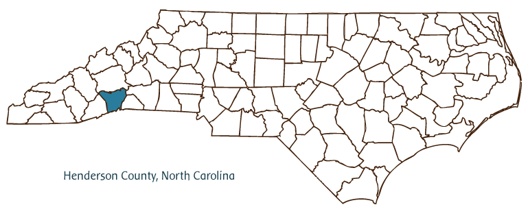
Henderson County, located in North Carolina's Mountain region, was formed from Buncombe County in 1838. Like its county seat, Hendersonville (incorporated in 1847), the county takes its name from Leonard Henderson, chief justice of the North Carolina Supreme Court from 1829 to 1833. Other Henderson County communities include Fletcher, Laurel Park, and Flat Rock.
Originally inhabited by the Cherokee, the site of modern-day Hendersonville was part of the early land grants west of the Blue Ridge Mountains. Revolutionary War soldier William Mills, who settled his new property in 1787, is credited with establishing the foundations for the county and its principal city. Mills planted hundreds of fruit trees in the area, in addition to more typical crops, and today Henderson County leads the state in apple production. The county's modern economy depends more, however, on its tourist industry and retirement facilities than on agriculture. Visitors can enjoy a full range of outdoor activities-from hiking through the Pisgah National Forest to taking in the panoramic views from scenic overlooks along the Blue Ridge Parkway and other highways-while the county's tranquil setting and mild climate have earned it a place among the nation's top retirement destinations. Literary giant Carl Sandburg spent the last 22 years of his life in Flat Rock, and Connemara, his home and farm, are preserved as a historic site. Flatrock Playhouse, established in the early 1940s, is the official North Carolina State Theater. Henderson County had an estimated population of slightly more than 96,000 in 2004.
Annotated history of Henderson County's formation:
For an annotated history of the county's formation, with the laws affecting the county, boundary lines and changes, and other origin information, visit these references in The Formation of the North Carolina Counties (Corbitt, 2000), available online at North Carolina Digital Collections (note, there may be additional items of interest for the county not listed here):
County formation history: https://digital.ncdcr.gov/Documents/Detail/the-formation-of-the-north-ca...
Index entry for the county: https://digital.ncdcr.gov/Documents/Detail/the-formation-of-the-north-ca...
References:
The Heritage of Henderson County, North Carolina (1985-88).
Lenoir Ray, Postmarks: A History of Henderson County, North Carolina, 1787-1968 (1970).
Additional resources:
Corbitt, David Leroy. 2000. The formation of the North Carolina counties, 1663-1943. https://digital.ncdcr.gov/Documents/Detail/the-formation-of-the-north-carolina-counties-1663-1943/3692099?item=4553233 (accessed June 20, 2017).
Henderson County Government: https://www.hendersoncountync.gov/
Henderson County Tourism Development Authority: http://www.historichendersonville.org/
DigitalNC, Henderson County: https://www.digitalnc.org/counties/henderson-county/
North Carolina Digital Collections (explore by place, time period, format): https://digital.ncdcr.gov
Image credits:
Rudersdorf, Amy. 2010. "NC County Maps." Government & Heritage Library, State Library of North Carolina.
1 January 2006 | Vocci, Robert Blair