
JOHNSTON COUNTY GOVERNMENT:
www.johnstonnc.com
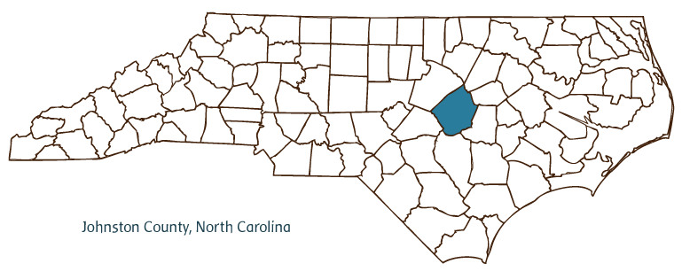
COUNTY SEAT: Smithfield
FORMED: 1746
FORMED FROM: Craven
LAND AREA: 791.30 square miles
2020 POPULATION ESTIMATE: 215,999
White: 78.8%
Black/African American: 17.0%
American Indian: 0.9%
Asian: 0.9%
Pacific Islander: 0.1%
Two or more races: 2.2%
Hispanic/Latino: 14.1% (of any race)
From State & County QuickFacts, US Census Bureau, 2020.
CONGRESSIONAL DISTRICT: 2ND, 7TH
BIOGRAPHIES FOR![]()
Johnston County
 WILDLIFE PROFILES FOR
Coastal Plain
GEOGRAPHIC INFORMATION
REGION: Coastal Plain
RIVER BASIN: Neuse, Map
NEIGHBORING COUNTIES: Harnett, Nash, Sampson, Wake, Wayne, Wilson
See also: Bentonville, Battle of.
Johnston County, located in North Carolina's Coastal Plain region, was formed from Craven County in 1746, taking its name from Royal Governor of North Carolina Gabriel Johnston. Communities in the county include the county seat of Smithfield (incorporated in 1777), Clayton, Selma, Benson, Kenly, Four Oaks, Pine Level, Princeton, Wilson's Mills, and Micro.
Johnston County was originally inhabited by Tuscarora Indians, most of whom migrated to New York-joining the Iroquois, to whom they were related-when their efforts to resist European settlement in the area ended with their defeat in the Tuscarora War (1711-13). The county's first town, Smithfield, was then established as an early trading post along the banks of the Neuse River at Smith's Ferry. During the nineteenth century, cotton emerged as Johnston County's chief product, while the simultaneous extension of the railroad facilitated its shipping for commercial purposes; Selma, located at the junction of the North Carolina and Atlantic Coast Line railroads, became the county's second commercial center. Fluctuating cotton prices during the late nineteenth century paved the way for a rise in tobacco production, bringing the county a new prosperity that ended only with the onset of the Great Depression. The postwar era, which introduced productivity-boosting highways to the county, brought an increase in manufacturing to compensate for declining job prospects in the agricultural sector. Nevertheless, Johnston County remains heavily dependent upon farming, with more farms than any other North Carolina county and standing as the leading county in the state in terms of total income derived from agricultural crops, such as sweet potatoes, corn, and soybeans. It also continues to be a state leader in the production of flue-cured tobacco.
Johnston County's Bentonville Battleground State Historic Site commemorates the last major battle of the Civil War, also notable as the largest military engagement in North Carolina's history. The county is also home to the Ava Gardner Museum in Smithfield, a tribute to the Johnston County native and screen legend. The town of Benson annually hosts the popular Mule Days festival. The Tobacco Farm Life Museum in Kenly interprets the history of tobacco farming in the state. Growth in the Triangle area has accelerated a modern housing boom in Johnston County, which had an estimated population of 141,300 in 2004.
Annotated history of Johnston County's formation:
For an annotated history of the county's formation, with the laws affecting the county, boundary lines and changes, and other origin information, visit these references in The Formation of the North Carolina Counties (Corbitt, 2000), available online at North Carolina Digital Collections (note, there may be additional items of interest for the county not listed here):
County formation history: https://digital.ncdcr.gov/Documents/Detail/the-formation-of-the-north-ca...
Index entry for the county: https://digital.ncdcr.gov/Documents/Detail/the-formation-of-the-north-ca...
References:
Thomas J. and T. Wingate Lassiter, Johnston County: Its History since 1746 (2004).
Additional resources:
Corbitt, David Leroy. 2000. The formation of the North Carolina counties, 1663-1943. https://digital.ncdcr.gov/Documents/Detail/the-formation-of-the-north-carolina-counties-1663-1943/3692099?item=4553233 (accessed June 20, 2017).
Johnston County Government: http://www.johnstonnc.com
Greater Smithfield-Selma Chamber of Commerce: https://www.triangleeastchamber.com/
DigitalNC, Johnston County: https://www.digitalnc.org/counties/johnston-county/
North Carolina Digital Collections (explore by place, time period, format): https://digital.ncdcr.gov
Image credits:
Rudersdorf, Amy. 2010. "NC County Maps." Government & Heritage Library, State Library of North Carolina.
1 January 2006 | Vocci, Robert Blair