Madison County Resources
- View All:
- Biographies
- Monuments
- locations
ANCHOR (A North Carolina History Online Resource) is now its own website!
We have rescheduled our maintenance on NCpedia to Friday, May 22, beginning at 3 pm. You may experience access issues over the weekend (May 23 and 24). We apologize for the inconvenience.
Copyright Notice: This article is from the Encyclopedia of North Carolina edited by William S. Powell. Copyright © 2006 by the University of North Carolina Press. Used by permission of the publisher. For personal use and not for further distribution. Please submit permission requests for other use directly to the publisher.
See also: Hot Springs; Shelton Laurel Massacre.

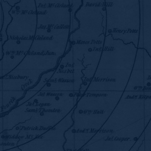
Madison County, located in North Carolina's Mountain region, was formed from Buncombe and Yancey Counties in 1851 and was named for President James Madison. Communities include the county seat of Marshall (incorporated in 1863), Mars Hill, Faust, Hot Springs, Spring Creek, Joe, Trust, Luck, Walnut, and Whiterock.
Located along North Carolina's border with Tennessee, the area that became Madison County was, like many of the state's Mountain counties, originally inhabited by the Cherokee and then settled by immigrants from Scotland and Ireland. The Shelton Laurel Massacre, the execution of several men and boys suspected of Unionist sympathies in 1863, led to the moniker "Bloody Madison." Due in part to its geographic isolation, the county has preserved a vibrant folk tradition that has incorporated the customs of these Scot-Irish pioneers. English folklorist Cecil Sharp collected ballads in the region in 1916. The mountains also yield a wide variety of outdoor recreational opportunities, including skiing, hiking, and mountain biking, while the French Broad River is a popular destination for whitewater rafting as well as canoeing, kayaking, and fishing. In addition, Madison County is home to Hot Springs, a resort named for its warm mineral waters, which flourished in the nineteenth century (and for a brief period during World War I held German prisoners of war). Mars Hill College, a Baptist school, was established in 1856. As vital as tourism is to Madison County's economy, its farms and forests-principally tobacco but also Christmas trees and other products-remain its driving force. The estimated population of Madison County was 20,000 in 2004.
For an annotated history of the county's formation, with the laws affecting the county, boundary lines and changes, and other origin information, visit these references in The Formation of the North Carolina Counties (Corbitt, 2000), available online at North Carolina Digital Collections (note, there may be additional items of interest for the county not listed here):
County formation history: https://digital.ncdcr.gov/Documents/Detail/the-formation-of-the-north-ca...
Index entry for the county: https://digital.ncdcr.gov/Documents/Detail/the-formation-of-the-north-ca...
Additional resources:
Corbitt, David Leroy. 2000. The formation of the North Carolina counties, 1663-1943. https://digital.ncdcr.gov/Documents/Detail/the-formation-of-the-north-carolina-counties-1663-1943/3692099?item=4553233 (accessed June 20, 2017).
Madison County Government: https://www.madisoncountync.gov/
Madison County Chamber of Commerce: https://www.madisoncounty-nc.com
DigitalNC, Madison County: https://www.digitalnc.org/counties/madison-county/
North Carolina Digital Collections (explore by place, time period, format): https://digital.ncdcr.gov
Image credits:
Rudersdorf, Amy. 2010. "NC County Maps." Government & Heritage Library, State Library of North Carolina.
Vocci, Robert Blair. "Madison County." NCpedia. Library of NC. July 2023.
MADISON COUNTY GOVERNMENT:
madisoncountync.gov
COUNTY SEAT: Marshall
FORMED: 1851
FORMED FROM: Buncombe, Yancey
LAND AREA: 449.57 square miles
2020 POPULATION ESTIMATE: 21,193
White: 96.1%
Black/African American: 1.5%
American Indian: 0.5%
Asian: 0.5%
Pacific Islander: <0.1%
Two or more races: 1.4%
Hispanic/Latino: 2.4% (of any race)
From State & County QuickFacts, US Census Bureau, 2020.
CONGRESSIONAL DISTRICT: 11TH
BIOGRAPHIES FOR![]()
Madison County
 WILDLIFE PROFILES FOR
Mountain region
GEOGRAPHIC INFORMATION
REGION: Mountain
RIVER BASIN: French Broad, Map
NEIGHBORING COUNTIES: Buncombe, Haywood, Yancey