Robeson County Resources
- View All:
- Biographies
- Monuments
- locations
ANCHOR (A North Carolina History Online Resource) will soon have its own website!
We are setting up redirects so links to current ANCHOR pages on NCpedia will send users to the new site in the future.
Copyright Notice: This article is from the Encyclopedia of North Carolina edited by William S. Powell. Copyright © 2006 by the University of North Carolina Press. Used by permission of the publisher. For personal use and not for further distribution. Please submit permission requests for other use directly to the publisher.
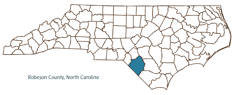
Robeson County, located in the Coastal Plain region of North Carolina, was formed in 1787 from Bladen County and was named for Revolutionary War colonel Thomas Robeson. The Saura (Cheraw) and Lumbee were the area's earliest inhabitants, followed by Scottish, English, Welsh, and French settlers. Lumberton, the county seat, was incorporated in 1788 and named after the Lumber River. Other communities in the county include Pembroke, Rowland, Maxton, Red Springs, Parkton, Lumber Bridge, Allenton, Alma, and Shannon. Notable physical features of the county, in addition to the Lumber River, include Panther and Horse Pen Branches, Gum Swamp Canal, and Currie and Bear Bays.
Much of Robeson County's history has involved the trials and accomplishments of the Lumbee Indians, North Carolina's largest tribe, who populate the region. One of their most famous tribal members, Henry Berry Lowry, led a band of outlaws in the state during and after the Civil War, at times using violence to bring attention to the plight of the Lumbee. His story is the subject of the long-running outdoor drama Strike at the Wind!, performed in Pembroke during the summer months. Lowry's restored cabin is on display at an adjacent recreational area.
Robeson County has a number of historic sites and landmarks, including the Luther Henry Caldwell House, built around 1903; the Carolina Theatre, built in 1927; and the Archie Buie House, built in 1902. Cultural institutions include Robeson Little Theatre, the North Carolina Indian Cultural Center, the Border Belt Farmer's Museum, and the Robeson County Showcase Museum. Robeson County is also home to the University of North Carolina at Pembroke, which was established in 1887 as the Croatan Normal School and became a campus of the consolidated University of North Carolina in 1972. The county hosts festivals such as St. Paul's Annual Festival, Fairmont Farmers Festival, the Native American Wild Game Festival, and the Lumbee Spring Pow Wow.
Agricultural commodities raised in Robeson County include tobacco, cotton, soybeans, vegetables, poultry, hogs, and beef cattle, and manufactures include transformers, water pipes and valves, speakers, textiles, wood products, and manufactured homes. The estimated population of Robeson County in 2004 was 126,500.
For an annotated history of the county's formation, with the laws affecting the county, boundary lines and changes, and other origin information, visit these references in The Formation of the North Carolina Counties (Corbitt, 2000), available online at North Carolina Digital Collections (note, there may be additional items of interest for the county not listed here):
County formation history: https://digital.ncdcr.gov/Documents/Detail/the-formation-of-the-north-ca...
Index entry for the county: https://digital.ncdcr.gov/Documents/Detail/the-formation-of-the-north-ca...
References:
Adolph L. Dial, The Lumbee (1993).
Additional resources:
Corbitt, David Leroy. 2000. The formation of the North Carolina counties, 1663-1943. https://digital.ncdcr.gov/Documents/Detail/the-formation-of-the-north-carolina-counties-1663-1943/3692099?item=4553233 (accessed June 20, 2017).
Robeson County Government: https://www.robesoncountync.gov
Lumberton Chamber of Commerce: http://www.lumbertonchamber.com/
DigitalNC, Robeson County: https://www.digitalnc.org/counties/robeson-county/
North Carolina Digital Collections (explore by place, time period, format): https://digital.ncdcr.gov
Image credits:
Rudersdorf, Amy. 2010. "NC County Maps." Government & Heritage Library, State Library of North Carolina.
Mazzocchi, Jay. "Robeson County." NCpedia. State Library of NC. 2006. https://www.ncpedia.org/geography/robeson.

ROBESON COUNTY GOVERNMENT:
co.robeson.nc.us
COUNTY SEAT: Lumberton
FORMED: 1787
FORMED FROM: Bladen
LAND AREA: 949.22 square miles
2020 POPULATION ESTIMATE: 116,530
White: 30.6%
Black/African American: 23.6%
American Indian: 42.3%
Asian: 0.7%
Pacific Islander: 0.2%
Two or more races: 2.7%
Hispanic/Latino: 9.2% (of any race)
From State & County QuickFacts, US Census Bureau, 2020.
CONGRESSIONAL DISTRICT: 9TH
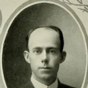
BIOGRAPHIES FOR![]()
Robeson County
 WILDLIFE PROFILES FOR
Coastal Plain
GEOGRAPHIC INFORMATION
REGION: Coastal Plain
RIVER BASIN: Lumber, Map
NEIGHBORING COUNTIES: Bladen, Columbus, Cumberland, Hoke, Scotland