Scotland County Resources
- View All:
- Biographies
- Monuments
- locations
ANCHOR (A North Carolina History Online Resource) is now its own website!
Copyright Notice: This article is from the Encyclopedia of North Carolina edited by William S. Powell. Copyright © 2006 by the University of North Carolina Press. Used by permission of the publisher. For personal use and not for further distribution. Please submit permission requests for other use directly to the publisher.
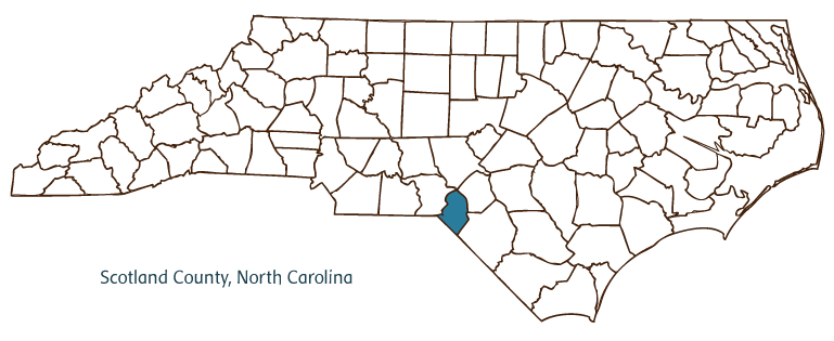
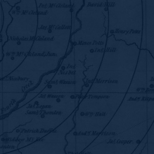
Scotland County, located at the border of the Piedmont and Coastal Plain regions of North Carolina, was formed in 1899 from Richmond County and named for the ancestral home of many of its inhabitants. It partially borders the state of South Carolina. Early inhabitants of the area included the Saura (Cheraw) Indians, followed by Highland Scots and English settlers. Groups of Quakers also migrated to the area in the eighteenth century. The county seat, Laurinburg, was incorporated in 1877 and named for the McLaurin family, prominent among the county's early Scottish settlers. Other communities in the county include East Laurinburg, Gibson, Old Hundred, Laurel Hill, Hasty, and Johns. Notable physical features of the county include the Lumber River, Shoe Heel and Jordan Creeks, Big Muddy Lake, Juniper Swamp, and McNair Pond.
Scotland County's heritage as a destination for thousands of Scottish settlers during the eighteenth century greatly influenced its growth and development. St. Andrews Presbyterian College, the successor of a number of Presbyterian educational institutions dating back to the nineteenth century, was established in Laurinburg in 1958. It houses the Scottish Heritage Center. The county is home to several historic sites and landmarks, including Camp Mackall Military Reservation (1943), the Richmond Temperance and Literary Society Hall (1860), and the Jesse Mason House (1895). Cultural institutions include the Indian Museum of the Carolinas in Laurinburg, and the Vardell Art Gallery. The county hosts festivals and annual events such as the John Blue Cotton Festival, ScotchFest, and the Laurinburg Christmas Parade.
Scotland County generates forest products and agricultural goods such as cotton, corn, soybeans, tobacco, and swine. Manufactured products include textiles and apparel, hospital equipment, cabinet accessories, and mobile homes. The population of Scotland County was estimated to be 36,800 in 2004.
For an annotated history of the county's formation, with the laws affecting the county, boundary lines and changes, and other origin information, visit these references in The Formation of the North Carolina Counties (Corbitt, 2000), available online at North Carolina Digital Collections (note, there may be additional items of interest for the county not listed here):
County formation history: https://digital.ncdcr.gov/Documents/Detail/the-formation-of-the-north-ca...
Index entry for the county: https://digital.ncdcr.gov/Documents/Detail/the-formation-of-the-north-ca...
Additional resources:
Corbitt, David Leroy. 2000. The formation of the North Carolina counties, 1663-1943. https://digital.ncdcr.gov/Documents/Detail/the-formation-of-the-north-carolina-counties-1663-1943/3692099?item=4553233 (accessed June 20, 2017).
Scotland County Government: http://www.scotlandcounty.org/
Laurinburg and Scotland County Chamber of Commerce: https://www.laurinburgchamber.com/
DigitalNC, Scotland County: https://www.digitalnc.org/counties/scotland-county/
North Carolina Digital Collections (explore by place, time period, format): https://digital.ncdcr.gov
Image credits:
Rudersdorf, Amy. 2010. "NC County Maps." Government & Heritage Library, Library of North Carolina.
Mazzocchi, Jay. "Scotland County." NCpedia. Library of NC. 2006.

SCOTLAND COUNTY GOVERNMENT:
www.scotlandcounty.org
COUNTY SEAT: Laurinburg
FORMED: 1899
FORMED FROM: Richmond
LAND AREA: 318.85 square miles
2020 POPULATION ESTIMATE: 34,174
White: 44.6%
Black/African American: 38.9%
American Indian: 12.8%
Asian: 0.9%
Pacific Islander: 0.1%
Two or more races: 2.7%
Hispanic/Latino: 3.3% (of any race)
From State & County QuickFacts, US Census Bureau, 2020.
CONGRESSIONAL DISTRICT: 9TH
![]() BIOGRAPHIES FOR
BIOGRAPHIES FOR
Scotland County
 WILDLIFE PROFILES FOR
Coastal Plain
GEOGRAPHIC INFORMATION
REGION: Coastal Plain
RIVER BASIN: Lumber, Map
NEIGHBORING COUNTIES: Hoke, Richmond, Robeson