Moore County Resources
- View All:
- Biographies
- Monuments
- locations
ANCHOR (A North Carolina History Online Resource) is now its own website!
Copyright Notice: This article is from the Encyclopedia of North Carolina edited by William S. Powell. Copyright © 2006 by the University of North Carolina Press. Used by permission of the publisher. For personal use and not for further distribution. Please submit permission requests for other use directly to the publisher.
See also: Carolina Hotel; Golf; House in the Horseshoe; Resorts.
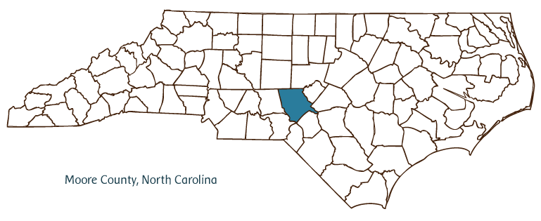
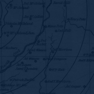
Moore County, located in the Sandhills on the border between North Carolina's Piedmont and Coastal Plain regions, was formed in 1784 from Cumberland County and named for Alfred Moore, a Revolutionary War captain who later served as a U.S. Supreme Court justice. Early inhabitants of the area included the Saura (Cheraw) and other Siouan Indians, followed by Highland Scot, German, English, and Scot-Irish settlers. Carthage, the county seat, was incorporated in 1796 and named after the ancient North African city. Other communities in the county include Aberdeen, Cameron, Robbins, Seven Lakes, Eastwood, Hill Crest, Eagle Springs, and Parkwood. Notable physical features of the county include Pine Lake and Drowning, Herds, Sugar, Big Juniper, and Little Crane Creeks.
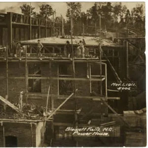
The Moore County economy benefits greatly from a thriving tourism and recreation industry centered on the resort towns of Pinehurst and Southern Pines-home to some of the nation's finest golf courses. The Pinehurst Golf Club, with its world-famous Number Two course, was established in 1903. Pinehurst hosted the 2005 U.S. Open Championship and annually hosts the Pinehurst Men's North/South Amateur Golf Tournament. Pottery is a vital part of the local economy; Jugtown is in Randolph County, but many of the craft's pioneering families lived and worked in Moore County. The health care and retirement industry in the county also has grown significantly over the years. Agricultural goods produced on Moore County farms include tobacco, peaches, strawberries, and poultry. Machine tools and furniture are manufactured in the county, and amethyst, zircon, copper, and quartz crystals are mined there.
Moore County landmarks and historic sites include the House in the Horseshoe State Historic Site, scene of a 1781 Patriot-Loyalist skirmish; Aberdeen Historic District, featuring 96 historic buildings; and the stately Carolina Hotel (1901), today part of the Pinehurst resort complex. Cultural institutions include the Campbell House Galleries, Sandhills Council Garden Clubs, and the Tufts Archives, located within the Given Memorial Library. Festivals and annual events held in Moore County include the Moore County Agricultural Fair, the Carthage Buggy Festival, the Pet Parade and Bark-in-the-Park Festival, and the North Carolina Playwright Festival. Moore County had an estimated population of 79,300 in 2004.
For an annotated history of the county's formation, with the laws affecting the county, boundary lines and changes, and other origin information, visit these references in The Formation of the North Carolina Counties (Corbitt, 2000), available online at North Carolina Digital Collections (note, there may be additional items of interest for the county not listed here):
County formation history: https://digital.ncdcr.gov/Documents/Detail/the-formation-of-the-north-ca...
Index entry for the county: https://digital.ncdcr.gov/Documents/Detail/the-formation-of-the-north-ca...
References:
Manly Wade Wellman, Story of Moore County: Two Centuries of a North Carolina Region (1974).
Additional resources:
Corbitt, David Leroy. 2000. The formation of the North Carolina counties, 1663-1943. https://digital.ncdcr.gov/Documents/Detail/the-formation-of-the-north-carolina-counties-1663-1943/3692099?item=4553233 (accessed June 20, 2017).
Moore County Government: https://www.moorecountync.gov/
Moore County Chamber of Commerce: http://www.moorecountychamber.com/
DigitalNC, Moore County: https://www.digitalnc.org/counties/moore-county/
House in the Horseshoe: http://www.nchistoricsites.org/horsesho/horsesho.htm
North Carolina Digital Collections (explore by place, time period, format): https://digital.ncdcr.gov
Image credits:
Rudersdorf, Amy. 2010. "NC County Maps." Government & Heritage Library, State Library of North Carolina.
Mazzocchi, Jay. "Moore County." NCpedia. Library of NC. July 2023.
MOORE COUNTY GOVERNMENT:
www.moorecountync.gov
COUNTY SEAT: Carthage
FORMED: 1784
FORMED FROM: Cumberland
LAND AREA: 697.84 square miles
2020 POPULATION ESTIMATE: 99,727
White: 83.1%
Black/African American: 12.0%
American Indian: 1.0%
Asian: 1.6%
Pacific Islander: 0.2%
Two or more races: 2.1%
Hispanic/Latino: 7.1% (of any race)
From State & County QuickFacts, US Census Bureau, 2020.
CONGRESSIONAL DISTRICT: 8TH
BIOGRAPHIES FOR![]()
Moore County
 WILDLIFE PROFILES FOR
Piedmont region
GEOGRAPHIC INFORMATION
REGION: Piedmont, though technically some parts of the county are in the Coastal Plain
RIVER BASIN: Cape Fear, Lumber, Map
NEIGHBORING COUNTIES: Chatham, Cumberland, Harnett, Hoke, Lee, Montgomery, Randolph, Richmond