Creative Commons BY-SA
This Creative Commons license allows re-users to distribute, remix, adapt, and build upon the material in any medium or format, so long as attribution (credit) is given to the creator. The license allows for commercial use. If you remix, adapt, or build upon the material, you must license the modified material under the same terms. For more information about Creative Commons licensing and a link to the license, see full details at https://creativecommons.org/licenses/by-sa/4.0/.
Citation
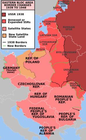
User Mosedschurte. Former Eastern Bloc area border changes between 1938 and 1948. Map. June 1, 2009. https://commons.wikimedia.org/wiki/File:EasternBloc_BorderChange38-48.s… (accessed May 26, 2022).
 1230786000