Public Domain
Public Domain is a copyright term that is often used when talking about copyright for creative works. Under U.S. copyright law, individual items that are in the public domain are items that are no longer protected by copyright law. This means that you do not need to request permission to re-use, re-publish or even change a copy of the item. Items enter the public domain under U.S. copyright law for a number of reasons: the original copyright may have expired; the item was created by the U.S. Federal Government or other governmental entity that views the things it creates as in the public domain; the work was never protected by copyright for some other reason related to how it was produced (for example, it was a speech that wasn't written down or recorded); or the work doesn't have enough originality to make it eligible for copyright protection.
Citation
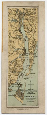
Barnes, R. F. Map of the Cape Fear River and the approaches to Wilmington, N.C. ca. 1862. Map. North Carolina State Archives, Raleigh, N.C. Available online through UNC Chapel Hill Libraries, North Carolina Maps. https://dc.lib.unc.edu/cdm/singleitem/collection/ncmaps/id/1262/rec/8.
