Creative Commons BY-NC-SA
This item has a Creative Commons license for re-use. This Creative Commons BY-NC-SA license means that you may use, remix, tweak, and build upon the work for non-commercial purposes as long as you credit the original creator and as long as you license your new creation using the same license. For more information about Creative Commons licensing and a link to the license, see full details at https://creativecommons.org/licenses/by-nc-sa/4.0/.
Citation
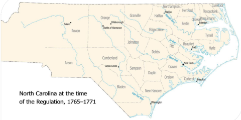
Carolina K-12, Carolina Public Humanities. "Map of North Carolina at the time of the Regulation (1765-1771)." Illustration. In "North Carolina's Regulator Movement" (slide presentation). https://k12database.unc.edu/wp-content/uploads/sites/31/2014/06/RegulatorsPPT.pdf