915166800
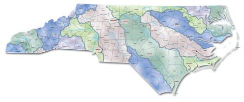
A river basin encompasses all the land surface drained by many finger-like streams and creeks flowing downhill into one another and eventually into one river, which forms its artery and backbone. As a bathtub catches all the water that falls within its sides and directs the water out its drain, a river basin sends all the water falling within its surrounding ridges into its system of creeks and streams to gurgle and splash downhill into its river and out to an estuary or the ocean.
The shape of a river basin comes from the collective and opposing forces of mountain-building and weathering. Geological forces push mountains up into the sky, and weathering from rain and wind wears mountainsides into hillsides and valleys and plains. A jigsaw puzzle of river basins reflects in three dimensions the outcome of these combined forces molding the landscape.
As an artery connects the parts of a body to one another, so a river threads together the creeks and streams, valleys and hills, springs and lakes that share a common assembly of water. What happens to the surface or underground water in part of the river basin will find its way to other parts. If water is diverted out of its usual course in one part of a river basin, other parts will know its absence. A river basin comes closer than any other defined area of land, with the exception of an isolated island, to meeting the definition of an ecosystem in which all things are connected and interdependent.
All Rights Reserved
 915166800