Printer-friendly page

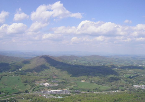
View from Mount Jefferson, North Carolina

View from Mount Jefferson, North Carolina

This is the view of West Jefferson from Mount Jefferson in Ashe County, North Carolina. Clouds cast shadows on the mountainous terrain below. A highway cuts through the valley, and the buildings of West Jefferson are visible nearby.

Mount Jefferson is part of the Mount Jefferson State Natural Area. It rises over 1,600 feet above the surrounding terrain, making it one of Ashe County’s most prominent landmarks. It is known for its diverse animal and plant life. On a particularly clear day, you can see the New River from the peak, which is accessible by one of the mountain many hiking trails.

<img typeof="foaf:Image" src="http://statelibrarync.org/learnnc/sites/default/files/images/ashecowestjeff.jpg" width="694" height="487" alt="View from Mount Jefferson, North Carolina" title="View from Mount Jefferson, North Carolina" />
Usage Statement: 

Creative Commons BY-NC-SA

This item has a Creative Commons license for re-use.  This Creative Commons BY-NC-SA license means that you may use, remix, tweak, and build upon the work for non-commerical purposes as long as you credit the original creator and as long as you license your new creation using the same license. For more information about Creative Commons licensing and a link to the license, see full details at https://creativecommons.org/licenses/by-nc-sa/4.0/.