by Emily Horton

NC Government & Heritage Library, 2012.

See also:
Climate and Weather (from the Encyclopedia of North Carolina)
Climate and Weather Overview (from NC Atlas Revisited)

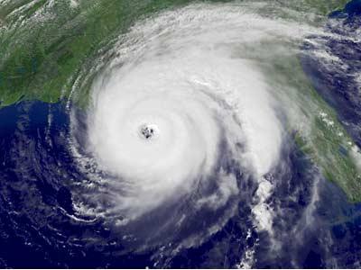
"Hurricane Ivan, 2004," Image courtesy of NCSU, Climate and Weather.
"Hurricane Ivan, 2004," Image courtesy of NCSU, Climate and Weather.North Carolina is located in the warm temperate zone. However, the difference in elevation across the state results in a variety of weather conditions throughout the three regions.

Average Rainfall Per Year: 44 inches

Average Snowfall Per Year: 5 inches

Lowest Temperature Recorded: -34°F on January 21,1985 in Mount Mitchell.

Highest Temperature Recorded: 110°F on August 21, 1983 in Fayetteville.

Regional Average Temperatures (°F)

Coastal Plain: Annual Average Temp: 66°F; January Average: lower 50's; August Average: mid 90's

Piedmont: Annual Average Temp: 60°F; January Average: upper 40's; August Average: mid-upper 90's

Mountains: Annual Average Temp: 55°F; January: lower 30's; August: mid-60's

Sources:

"North Carolina: Facts, Map, and State Symbol," Enchanted Learning, last modified 2010, http://www.enchantedlearning.com/usa/states/northcarolina/ (accessed March 26, 2012).

"North Carolina Geography and Climate," Secretary of State/Kids Page," http://www.secretary.state.nc.us/kidspg/ (accessed March 26, 2012).

Image Credits:

"Hurricane Ivan, 2004," NCSU, Climate and Weather.

Citation

Horton, Emily S. "Weather and Climate in a Snap!." NCpedia. Accessed on December 13th, 2024. https://www.ncpedia.org/weather-and-climate-snap.