Climate and landscape make much of North Carolina susceptible to soil erosion. Intensity and duration of rainfall, the measures of the rain's erosive power, are greater in the Southeast than elsewhere in the continental United States. During the nineteenth century, inefficient farming practices contributed significantly to the erosion of North Carolina's complex and varied soils; when North Carolina cotton, tobacco, and corn farmers hitched animal power to plows and cultivators to clean-till widely spaced rows, gullies opened on the landscape and the rivers ran red with clay sediments.
Southerners struggled to invent indigenous methods of soil conservation. Nicholas T. Sorsby, a North Carolina native, developed a system of farming around horizontal (contour) plowing and hillside ditching. Written first for the North Carolina Agricultural Society, his Horizontal Plowing and Hillside Ditching (1860) was the only book available on these conservation methods prior to the Civil War. Priestly H. Mangum developed the Mangum terrace around 1885 on his farm near Wake Forest. The broad-based terrace became widely adopted in the South and was advocated by various state agricultural agencies. The North Carolina Agricultural Experiment Station in West Raleigh experimented with terracing and by 1896 advocated Mangum terraces to the state's farmers. By 1915 Cleveland County had terraces on 6,000 acres, earning the moniker, the "county of terraces." Terracing was hardly a panacea and in fact sometimes concentrated runoff, causing gullies. Crop rotations of grasses, hay, legumes, or close-growing small grain crops protected the soil from raindrop impact through part of the year and added organic matter to the topsoil, thus increasing the rate of rainfall infiltration. However, the system of agriculture based on clean cultivated row crops made soil conservation a difficult proposition.
Hugh Hammond Bennett, a native of Anson County, earned the title "father of soil conservation" through his efforts to awaken the country to the impact of soil erosion on food production and the economic health of rural communities. Bennett graduated from the University of North Carolina in 1903 and joined the Bureau of Soils in the U.S. Department of Agriculture (USDA). His concern over soil was born of tramping southern fields while making soil surveys. In September 1933, after waging a campaign to start some watershed-based demonstrations of soil conservation with New Deal emergency employment funds, he became head of the Soil Erosion Service, later the Soil Conservation Service (SCS), an agency of the USDA whose main purpose was to help farmers use their land and water resources wisely, thus preventing or reducing loss of soil by flood or erosion. One of several demonstration projects in North Carolina included the Bennett home place in the Brown Creek watershed. When the Soil Conservation Service began extending help to landowners through locally organized and directed soil conservation districts, the Brown Creek Soil Conservation District became, on 4 Aug. 1937, the first recognized by the USDA. The SCS, today the Natural Resources Conservation Service, continues to work with districts, farmers, and local governments and groups throughout the state on soil conservation and other resource matters.
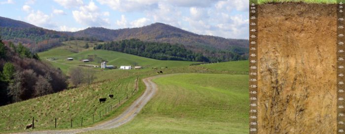
Beginning in the fall of 1934, the Soil Erosion Service and the National Resources Board undertook a national reconnaissance erosion survey; all 100 North Carolina counties have at least one published soil survey for comparison and land management purposes, and certain soil types are named after North Carolina locations: Alamance, Ashe, Conetoe, Fuquay, Georgeville, Goldsboro, Hyde, Mayodan, Pungo, Secrest, Wadesboro, Wake, and White Store. In this survey, erosion was found not to be severe in the Coastal Plain due to the region's gentle slopes combined with sandy soils, which allow rapid infiltration of rainfall and produce some of the richest farmland.
The story in the Piedmont and Mountain regions was very different. The loamy soil of the Piedmont is mostly sandy, red clay, producing some of the best farmland in the state with the greatest variety of crops, including cotton, tobacco, timber, small grains, hay, and corn. In the Mountains, the soils are usually a grayish brown loam, stony, shallow, and on steep slopes, allowing extensive pastureland and some crops of corn, hay, cabbage, and burley tobacco on properly terraced land. However, a soil type designated as Cecil, which covered large areas of the Piedmont, originally had a surface layer of sandy loam 12 to 14 inches thick underlain by 2 to 6 feet of heavy clay. The surface layer had been removed on much of the area. Statewide, the survey teams calculated that 9 percent of the land exclusive of water and large cities had lost three-fourths of its topsoil, 30 percent of the land had lost one-fourth to three-fourths of its topsoil, and 13 percent of the area had been gullied to some extent.
Two trends in land use have reduced soil erosion from cropland in North Carolina. First, there was a decrease in statewide cropland from about 7.7 million acres in 1949 to less than 5 million acres by the late 1990s. Second, land used for crops has been shifting from the Mountains and the Piedmont to the gentler slopes of the Coastal Plain. Comparing 1949 with 2004, Piedmont cropland shrank from 3.4 million acres to 929,000 acres, and Mountain cropland acreage decreased from 819,222 acres to 308,000 acres. Cropland in the Sandhills dropped from 128,648 acres to 61,469 by the early 1990s, and in the same period Coastal Plain cropland declined less severely from about 2.1 to 1.8 million acres. The flatwoods of the Coastal Plain remained fairly constant, with 932,254 acres in 1949 and 897,634 acres by 1992. The Tidewater section actually increased in total acreage, from 334,063 acres in 1949 to 565,448 acres in 1992.