Hyde County Resources
- View All:
- Biographies
- Monuments
- locations
ANCHOR (A North Carolina History Online Resource) is now its own website!
Copyright Notice: This article is from the Encyclopedia of North Carolina edited by William S. Powell. Copyright © 2006 by the University of North Carolina Press. Used by permission of the publisher. For personal use and not for further distribution. Please submit permission requests for other use directly to the publisher.
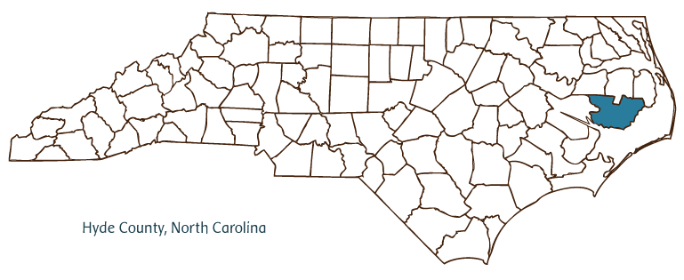
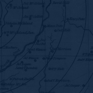
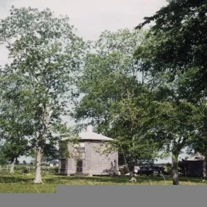
Hyde County, located in North Carolina's Coastal Plain region, was formed from Bath County in 1705. The area was originally inhabited by various Algonquian Indian tribes. The precinct of Wickham, as it was then known, was renamed Hyde in 1712 (taking its name from Lord Proprietor Edward Hyde) and became Hyde County in 1739. Over the course of the following century, the county seat was relocated from Woodstock to Bell's Bay (or Jasper's Creek) to Germantown to Lake Landing to Swan Quarter (settled ca. 1836), where it is today. Other communities in the sparsely populated county include Engelhard, Fairfield, Ocracoke, Sladesville, Panzer, Scranton, Beulah, New Holland, Nebraska, Gull Rock, and Newlands.
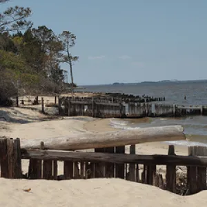
The islands and inlets of Hyde County greeted European explorers from the early sixteenth century through the seventeenth, as colonies were first established in the New World. For a time, particularly in the early eighteenth century, the region's port communities and sea vessels were terrorized by pirate raids, including those led by the notorious Blackbeard. In 1845 Ocracoke Island-which, up until that point, had been part of Carteret County-was annexed to Hyde County. Today the island is part of the Cape Hatteras National Seashore.
During the early 1900s, a massive land reclamation and drainage project was undertaken at Lake Mattamuskeet (North Carolina's largest natural lake) in order to pump fresh water from the lakebed out into the Pamlico Sound. With public funds and investments from private individuals (who organized themselves as the Southern Land Reclamation Company), canals were dredged and a pumping plant was built to house the largest centrifugal pumps ever designed. Plans to develop the newly drained lakebed were abandoned, however, and the area instead became a national wildlife refuge. Canals were again dredged through the mainland in the 1920s for the creation of the Intracoastal Waterway. The heretofore isolated Ocracoke Island, meanwhile, began to emerge as a tourist destination with the establishment of a ferry system in the late 1950s.
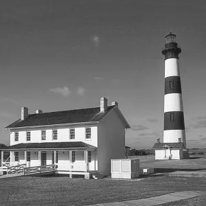
Other Hyde County natural and cultural attractions include the Swanquarter National Wildlife Refuge, the Ocracoke Lighthouse (1823), and the Ocracoke Museum. Festivals such as Hyde County Farm Days, Swan Days, and the Fairfield Heritage Bass Tournament are held annually in the county. The estimated population of Hyde County in 2004 was 5,600.
For an annotated history of the county's formation, with the laws affecting the county, boundary lines and changes, and other origin information, visit these references in The Formation of the North Carolina Counties (Corbitt, 2000), available online at North Carolina Digital Collections (note, there may be additional items of interest for the county not listed here):
County formation history: https://digital.ncdcr.gov/Documents/Detail/the-formation-of-the-north-ca...
Index entry for the county: https://digital.ncdcr.gov/Documents/Detail/the-formation-of-the-north-ca...
References:
Morgan H. Harris, Hyde Yesterdays: A History of Hyde County (1995).
Hyde County History: A Hyde County Bicentennial Project (1976).
Additional resources:
Corbitt, David Leroy. 2000. The formation of the North Carolina counties, 1663-1943. https://digital.ncdcr.gov/Documents/Detail/the-formation-of-the-north-carolina-counties-1663-1943/3692099?item=4553389 (accessed June 20, 2017).
Hyde County Government: http://www.hydecountync.gov/
DigitalNC, Hyde County: https://www.digitalnc.org/counties/hyde-county/
North Carolina Digital Collections (explore by place, time period, format): https://digital.ncdcr.gov
Image credits:
Rudersdorf, Amy. 2010. "NC County Maps." Government & Heritage Library, Library of North Carolina.
Vocci, Robert Blair. "Hyde County." NCpedia. Library of NC. 2006.
HYDE COUNTY GOVERNMENT:
http://www.hydecountync.gov/
COUNTY SEAT: Swan Quarter
FORMED: 1705
FORMED FROM: Bath
LAND AREA: 612.80 square miles
2020 POPULATION ESTIMATE: 4,589
White: 70.1%
Black/African American: 26.7%
American Indian: 0.8%
Asian: 0.7%
Pacific Islander: <0.1%
Two or more races: 1.7%
Hispanic/Latino: 9.8% (of any race)
From State & County QuickFacts, US Census Bureau, 2020.
CONGRESSIONAL DISTRICT: 3RD
BIOGRAPHIES FOR![]()
Hyde County
 WILDLIFE PROFILES FOR
Coastal Plain
GEOGRAPHIC INFORMATION
REGION: Coastal Plain
RIVER BASIN: Pasquotank, Tar-Pamlico, Map
NEIGHBORING COUNTIES: Beaufort, Dare, Tyrrell, Washington