Alleghany County Resources
- View All:
- Biographies
- Monuments
- locations
ANCHOR (A North Carolina History Online Resource) is now its own website!
Copyright Notice: This article is from the Encyclopedia of North Carolina edited by William S. Powell. Copyright © 2006 by the University of North Carolina Press. Used by permission of the publisher. For personal use and not for further distribution. Please submit permission requests for other use directly to the publisher.
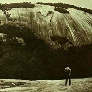
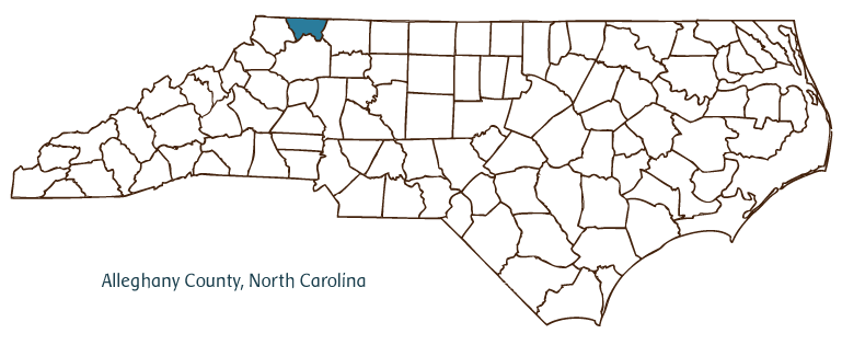 Alleghany County, located in the Blue Ridge Mountains of northwestern North Carolina and bordering Virginia, was formed in 1859 from Ashe County through an act of the North Carolina legislature. The first inhabitants of this land were people of the Cherokee and Shawnee tribes. By the late 1700s, these tribes were displaced when English, German, and Scot-Irish immigrants settled the area. The county name comes from either the Allegewi American Indian tribe or the Delaware tribe's word "oolikhanna" (beautiful stream). The county seat, Sparta, was established in 1825, with the original name of Bower's Store. Its name was changed to Gap Civil (1846) before becoming Sparta in 1879, named for the Greek city. Other important communities located in Alleghany County are Piney Creek, Glade Valley, Laurel Springs, Roaring Gap, Twin Oaks, and Stratford. In addition to the mountains of the Blue Ridge, the county's other significant physical features include the New River (one of the world's oldest rivers), the Little River, and a part of the Eastern Continental Divide.
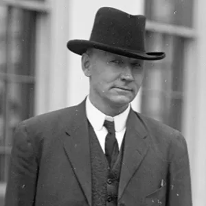
The construction of the Blue Ridge Parkway in the 1930s-made possible by the political efforts of longtime U.S. Congressman and Alleghany County native Robert Lee Doughton-brought increased tourism and growth to Alleghany County. However, the county remains North Carolina's fifth-smallest in land area (233 square miles) and its sixth-smallest in population (about 11,000 residents in 2004). Christmas trees make up a large portion of the agricultural goods produced by Alleghany County, generating an annual income in excess of $17 million. The production of dairy and beef cattle and other livestock is also a multimillion-dollar industry in Alleghany County.
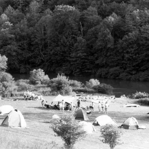
Alleghany County hosts several annual cultural festivals and events rooted in the region's mountain heritage, including the Blue Ridge Mountain Fair, the Mountain Heritage Festival, the Blue Ridge Mountains Crafts Fair, and Choose and Cut Day (for Christmas tree buyers).
For an annotated history of the county's formation, with the laws affecting the county, boundary lines and changes, and other origin information, visit these references in The Formation of the North Carolina Counties (Corbitt, 2000), available online at North Carolina Digital Collections (note, there may be additional items of interest for the county not listed here):
County formation history: https://digital.ncdcr.gov/Documents/Detail/the-formation-of-the-north-ca...
Index entry for the county: https://digital.ncdcr.gov/Documents/Detail/the-formation-of-the-north-ca...
Reference:
Alleghany Historical-Genealogical Society, Alleghany County Heritage (1983).
Additional resources:
Corbitt, David Leroy. 2000. The formation of the North Carolina counties, 1663-1943. https://digital.ncdcr.gov/Documents/Detail/the-formation-of-the-north-carolina-counties-1663-1943/3692099?item=4553233 (accessed June 20, 2017).
Alleghany County Government: https://alleghanycounty-nc.gov/
Alleghany County Chamber of Commerce: https://alleghanycountychamber.com/
DigitalNC, Alleghany County: https://www.digitalnc.org/counties/alleghany-county/
North Carolina Digital Collections (explore by place, time period, format): https://digital.ncdcr.gov
Image credits:
Rudersdorf, Amy. 2010. "NC County Maps." Government & Heritage Library, Library of North Carolina.
Rider, Bernadette. "Alleghany County." NCpedia. Library of NC. July 2023.
ALLEGHANY COUNTY GOVERNMENT:
https://alleghanycounty-nc.gov/
COUNTY SEAT: Sparta
FORMED: 1859
FORMED FROM: Ashe
LAND AREA: 235.06 square miles
2020 POPULATION ESTIMATE: 10,888
White: 95.4%
Black/African American: 1.8%
American Indian: 0.5%
Asian: 0.8%
Pacific Islander: <.1%
Two or more races: 1.4%
Hispanic/Latino: 9.9% (of any race)
From State & County QuickFacts, US Census Bureau, 2020.
CONGRESSIONAL DISTRICT: 5TH
BIOGRAPHIES FOR![]()
Alleghany County
 WILDLIFE PROFILES FOR
Mountain region
GEOGRAPHIC INFORMATION
REGION: Mountain
RIVER BASIN: New River, Map
NEIGHBORING COUNTIES: Ashe, Surry, Wilkes