Wayne County Resources
- View All:
- Biographies
- Monuments
- locations
ANCHOR (A North Carolina History Online Resource) will soon have its own website!
We are setting up redirects so links to current ANCHOR pages on NCpedia will send users to the new site in the future.
Copyright Notice: This article is from the Encyclopedia of North Carolina edited by William S. Powell. Copyright © 2006 by the University of North Carolina Press. Used by permission of the publisher. For personal use and not for further distribution. Please submit permission requests for other use directly to the publisher.

See also: Seymour Johnson Air Force Base.
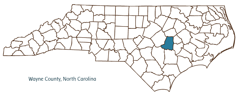
Wayne County, located in the Coastal Plain region of North Carolina, was formed in 1779 from Dobbs County and named for Revolutionary War general "Mad Anthony" Wayne. Early inhabitants of the area included the Saponi and Tuscarora Indians; English and Scotch-Irish settlers later populated the region. Goldsboro-named for Maj. Mathew Tilghman Goldsborough, assistant engineer on the Wilmington & Weldon Railroad, which passed through Wayne County-was incorporated in 1847 and replaced Waynesboro as the county seat in 1850. Other Wayne County communities include Mount Olive, Walnut Creek, Seven Springs, Eureka, Pikeville, Dobbersville, and Dudley. Notable physical features of the county are the Neuse River, Quaker Neck Lake, Burden and Kelley Creeks, Sasser Millpond, Juniper and Thoroughfare Swamps, and Exum Mill Run.
Seymour Johnson Air Force Base was established on the outskirts of Goldsboro in 1942 and has exerted a great influence on the city and its environs. Wayne County historic sites include the Weil House (1875), Paramount Theatre (1868), Goldsboro City Hall (1910), and the Governor Charles B. Aycock Birthplace, a mid-nineteenth-century homestead and 1893 schoolhouse. Cultural institutions include the Paramount Center for the Performing Arts, the Community Arts Council, the Stagestruck Theatre Company, the Goldsboro Civic Ballet, and the Wayne County Museum. Mount Olive College was founded in the county in 1951. The county hosts annual events and festivals such as the Wayne Regional Agricultural Fair, North Carolina Pickle Festival at Mount Olive (home of a leading pickle-producing company, which shares the town's name), and Fremont Daffodil Festival.
Wayne County agricultural products include cucumbers, soybeans, tobacco, corn, wheat, vegetables, cotton, poultry, and swine. Manufactured products include pickles and relishes, furniture, apparel, commercial baking equipment, and electric transformers. The estimated population of Wayne County was 115,000 in 2004.
For an annotated history of the county's formation, with the laws affecting the county, boundary lines and changes, and other origin information, visit these references in The Formation of the North Carolina Counties (Corbitt, 2000), available online at North Carolina Digital Collections (note, there may be additional items of interest for the county not listed here):
County formation history: https://digital.ncdcr.gov/Documents/Detail/the-formation-of-the-north-ca...
Index entry for the county: https://digital.ncdcr.gov/Documents/Detail/the-formation-of-the-north-ca...
Additional resources:
Corbitt, David Leroy. 2000. The formation of the North Carolina counties, 1663-1943. https://digital.ncdcr.gov/Documents/Detail/the-formation-of-the-north-carolina-counties-1663-1943/3692099?item=4553233 (accessed June 20, 2017).
Wayne County Government: http://www.waynegov.com/
Wayne County Chamber of Commerce: https://waynecountychamber.com/
DigitalNC, Wayne County: https://www.digitalnc.org/counties/wayne-county/
North Carolina Digital Collections (explore by place, time period, format): https://digital.ncdcr.gov
Image credits:
Rudersdorf, Amy. 2010. "NC County Maps." Government & Heritage Library, State Library of North Carolina.
Mazzocchi, Jay. "Wayne County." NCpedia. State Library of NC. 2006. https://www.ncpedia.org/geography/wayne.